

1. What Are Mammatus Clouds?
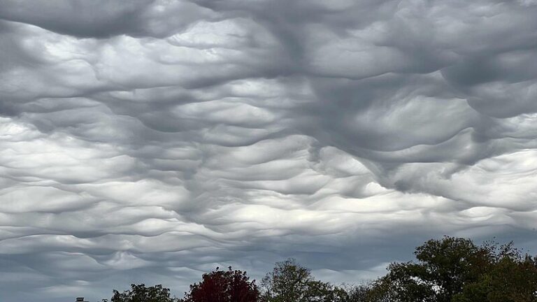
- Mammatus clouds (also known as “mamma” or “mammatocumulus”) create a cellular pattern of pouches suspended underneath cloud bases. While they often appear beneath cumulonimbus rainclouds, they can also attach themselves to other cloud types.
- The name “Mammatus” comes from the Latin word “mamma,” meaning “udder” or “breast.” These cloud formations certainly live up to their intriguing name!
2. Characteristics:
- Mammatus clouds are most commonly associated with anvil clouds and severe thunderstorms. They often extend from the base of a cumulonimbus cloud.
- These distinct “lumpy” undersides are formed by cold air sinking in a downwards direction, creating pockets of cloud contrary to the upward puffs formed by warm air convection.
- When you spot Mammatus, it’s like the sky saying, “Hey, check out my UFO impression!” 🛸
3. Height of Base:
- Mammatus clouds typically form between 6,500 and 16,500 feet above the ground. They thrive where the air is stable and winds flow across hills and mountains.
4. Flight and Soaring:
- While powered aircraft pilots avoid flying near Mammatus due to turbulence, glider pilots actively seek them out.
- Gliders use the upward-moving air at the leading edge of Mammatus clouds to soar to remarkable altitudes. It’s like catching a cosmic elevator to the sky!
5. Ominous Harbingers:
- True to their appearance, Mammatus clouds often precede severe weather. They can extend for hundreds of miles and remain visibly static for several minutes.
- Keep an eye open for these cosmic saucers—they’re the rebels with a meteorological cause! ☁️🌌🛸
Learn more about these celestial saucers and their high-altitude escapades! 🌦️🔍

Leave a Reply
You must be logged in to post a comment.