
0-9
A
- ACID RAIN
- Cloud or rain droplets containing pollutants, such as oxides of sulfur and nitrogen, to make them acidic.
- ADIABATIC
- Changes in temperature caused by the expansion (cooling) or compression (warming) of a body of air as it rises or descends in the atmosphere.
- ADVISORY
- The horizontal transport of air or atmospheric properties. Commonly used with temperatures, i.e., “warm air advection”, or moisture, i.e., “moisture advection”. ADVISORY- Issued for weather situations that cause significant inconveniences but do not meet warning criteria and, if caution is not exercised, could lead to life-threatening situation
- AEROSOL OPTICAL DEPTH
- a measure of how much light airborne particles prevent from passing through a column of atmosphere. Aerosols tend to absorb or reflect incoming sunlight, thus reducing visibility and increasing optical depth.
- AEROSOLS
- a collection of airborne particles, typically less than 100th of a millimetre in size, that reside in the atmosphere.
- AGL
- Above Ground Level
- AIR MASS
- A large body of air having similar horizontal temperature and moisture characteristics.
- ALBEDO
- The percentage of light reflected by an object.
- ALERT
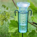
- Automated Local Event Reporting in Real Time. Network of automatic raingauges that transmit via VHF radio link when precipitation occurs. Some sites are also equipped with other sensors such as temperature, wind, pressure, river stage or tide level.
- ALTOCUMULUS
- (AC) – Mid-altitude clouds with a cumuliform shape.
- ALTOSTRATUS
- Mid-altitude clouds with a flat sheet-like shape.
- AMPLIFICATION
- Building, or sharpening, of an upper level high pressure ridge or low pressure trough.
- ANABATIC
- Wind flowing up an incline, such as up a hillside; upslope wind.
- ANEMOMETER
- An instrument that measures wind speed.
- ANGULAR MOMENTUM
- The energy of motion of a spinning body or mass of air or water.
- ANTHROPOGENIC
- caused or produced by humans.
- ANTICYCLONE
- A large area of high pressure around which the winds blow clockwise in the Northern Hemisphere.
- ARCTIC AIR
- A mass of very cold, dry air that usually originates over the Arctic Ocean north of Canada and Alaska.
- ARCTIC HIGH
- A very cold high pressure that originates over the Arctic Ocean.
- ASOS
- Automated Surface Observing System. Observes sky conditions, temperature and dewpoint, wind direction and speed, and barometric pressure.
- ASSIMILATION
- data assimilation combines recent observations with a previous weather forecast to obtain our best estimate of current atmospheric conditions. This is evolved forward in time by the forecast model to produce the next forecast.
- ATMOSPHERE
- The mass of air surrounding the earth and bound to it more or less permanently by the earth’s gravitational attraction.
- ATMOSPHERIC RIVER
- A long, narrow region in the atmosphere that transport water vapor, like a river in the sky.
- ATWC
- Alaska Tsunami Warning Center, located in Palmer, AK.
- AVALANCHE
- A large mass of rapidly moving snow down a steep mountain slope.
- AVHRR
- Advanced Very High Resolution Radiometer. Main sensor on U.S. polar orbiting satellites.
- AVN
- Aviation Model generated every 12 hours by NCEP.
- AWIPS
- Advanced Weather Information Processing System. New NWS computer system integrating graphics, satellite and radar imagery.
B
- BACKING WINDS
- A counterclockwise change in wind direction. Backing winds with height are indicative of cold air advection (CAA).
- BAROCLINICITY
- A cold air advection/warm air advection couplet that increases atmospheric instability. On analysis and forecast charts it is the isotherms crossing the height contours
- BAROMETER
- An instrument for measuring atmospheric pressure.
- BAROTROPIC
- Homogeneous atmosphere in which there are neither fronts nor any thermal advections.
- BEAUFORT SCALE
- A scale that indicates the wind speed using the effect wind has on certain familiar objects.
- BLACK ICE
- Thin, new ice that forms on fresh water or dew covered surfaces; it is common on roadways during the fall and early winter and appears “black” because of its transparency.
- BLACKBODY
- A mass which absorbs and emits all wavelengths of radiation
- BLIZZARD
- A storm lasting about 3 hours or longer with sustained winds 35 mph or greater with frequent gusts to 35 mph or greater; and considerable falling and/or blowing snow frequently reducing visibilities to less than 1/4 mile.
- BLOCKING PATTERN
- A situation in which the upper tropospheric flow becomes highly meridional and stagnant. Two common blocking patterns are the omaga block and the rex block.
- BLOWING DUST OR SAND
- Small particles of dust or sand which are caused by strong winds blowing over dry ground, that has little or no vegetation.
- BLOWING SNOW
- Wind-driven snow which reduces surface visibility.
- BOW ECHO
- An accelerated portion of a squall line of thunderstorms, taking on a radar indicated bow configuration, created by strong downburst winds
- BREEZY
- Sustained winds of 15 to 25 mph.
- BROKEN CLOUDS
- Clouds which cover between 6/10 and 9/10 of the sky.
C
- CAA
- Cold Air Advection. The movement of colder air toward a fixed point on the earth’s surface.
- CALM
- The absence of apparent motion in the air.
- CAP
- Temperature inversion which prevents convection from occurring.
- CAT
- A category. Usually refers to a category of precipitation given by the forecast models.
- CEILING
- The height of the lowest layer of clouds, when the sky is broken or overcast.
- CELSIUS
- A temperature scale in which zero is the freezing point of water and one hundred is the boiling point.
- CHANCE
- (CHC) – A 30, 40 or 50 percent chance of occurrence of measurable precipitation.
- CHINOOK
- A warm, dry wind that blows along the east slopes of the northern Rocky Mountains.
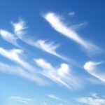
- CIRRIFORM
- High altitude ice clouds with a very thin wispy appearance.
- CIRROCUMULUS
- Cirrus clouds with vertical development.
- CIRROSTRATUS
- Cirrus clouds with a flat sheetlike appearance.
- CIRRUS
- CI – High clouds, usually above 18,000 feet, composed of ice crystals.
- CLASSIC EVENT
- Having all the ingredients for a specific type of weather (i.e. classic severe weather event, classic Nor’easter)
- CLEAR
- Sky condition of less than 1/10 cloud coverage.
- CLIMATE
- The historical record of average daily and seasonal weather events.
- CLIMATE MODEL
- a mathematical representation of the climate system based on its physical, chemical and biological components, in the form of a computer programme. The computer climate models used at the Met Office Hadley Centre are detailed three-dimensional representations of major components of the climate system. They are run on the Met Office supercomputer. Although there are other Climate models, the Met Office’s is deemed the best.
- CLOSED LOW
- (CUT OFF LOW) – A low pressure center having a closed circulation, which is used in reference to systems in the upper levels of the atmosphere. Closed lows that become cut off from the main flow pattern are called cut-off lows.
- CLOUD CONDENSATION NUCLEI
- Small particles in the air on which water vapor condenses and forms cloud droplets.
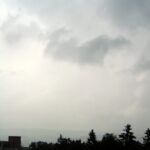
- CLOUDY
- The state of the sky when 9/10ths or more of the sky is covered by clouds.
- CO2
- carbon dioxide, a gas in Earth’s atmosphere. It occurs naturally and is also a by-product of human activity such as burning fossil fuels and land-use change. It is the principal anthropogenic greenhouse gas.
- COASTAL FLOODING
- Inundation of coastal areas from waves and storm surge.
- COLD CORE HIGH
- A dome of cold surface high pressure that originates from the high latitudes.
- COLD CORE LOW
- A low pressure which has the coldest temperatures located near its center. A cold core low is deep and is often associated with the polar jet stream. Mid-latitude cyclones are cold core lows.
- COLD FRONT
- The boundary between a cold air mass that is advancing and a relatively warmer airmass. Generally characterized by steady precipitation followed by showery precipitation.
- CONDENSATION
- The process of gas changing to liquid. The process by which water vapor changes into water droplets and clouds.
- CONDENSATION PRESSURE DEFICIT
- (COND PRES DEF)– On an isentropic chart (a layer of constant potential temperature), condensation pressure deficit represents the amount of lift, expressed in millibars, needed to saturate an air parcel.
- CONDUCTION
- The transfer of heat between bodies that are in contact.
- CONFLUENCE
- A 2-D process in which airstreams move toward each other at some angle.
- CONQ
- Converging Q vectors. Indicates air will rises due to low level warm air advection and/or upper level divergence.
- CONSIDERABLE CLOUDINESS
- Between 7/10 and 8/10 cloud cover.
- CONTINENTAL AIR MASS
- A dry air mass originating over a large land area.
- CONVECTION
- (CNVTN) – the transfer of heat within a gas or liquid by their movement.
- CONVERGENCE
- A 1-D process in which higher momentum air moves into lower momentum air.
- CORIOLIS FORCE
- An apparent force caused by the rotation of the earth. In the Northern Hemisphere winds are deflected to the right, and in the Southern Hemisphere to the left.
- CORONA
- A disk of light surrounding the sun or moon; this is a result of the diffraction of light by small water droplets.
- COUNTY WARNING AREA
- The area of responsibility that each National Weather Service office has for its warnings and forecasts.
- COUPLED MODELS
- coupled climate models combine representations of various components of the earth system such as atmosphere, ocean, sea ice and land surface. In coupled models each ‘coupled’ area of the earth system is influenced by other areas, as well as evolving independently.
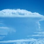
- CUMULONIMBUS
- A vertically developed cumulus cloud, often capped by an anvil shaped cloud. Also called a thunderstorm cloud, it is frequently accompanied by heavy showers, lightning, thunder, and sometimes hail or gusty winds.
- CUMULUS CLOUD
- (CU) – A cloud in the shape of individual detached domes, with a flat base and a bulging upper portion resembling cauliflower.
- CWA
- County Warning Area
- CYCLOGENESIS
- The development or strengthening of cyclonic circulation in the atmosphere.
- CYCLONE
- An area of low pressure around which winds blow counterclockwise in the Northern Hemisphere. Also the term used for a hurricane in the Indian Ocean and in the Western Pacific Ocean.
D
- DAMBREAK FLOODING
- Dambreaks present a unique flood warning problem. Dams may erode and empty relatively slowly. In these situations, when river forecasts are available, flood warnings and flood statements are used. Dams may also fail catastrophically during a heavy rainfall event or earthquake, resulting in a very dangerous flash flood-type situation. For these events, Flash Flood watches, warnings and statements will be used. Similar action may be required for the failure of certain levees.
- DEFORMATION ZONE
- (DFRMTN ZN) – An area in the atmosphere where winds converge along one axis and diverge along another. Deformation zones (or axis of deformation as they are sometimes referred to) can produce clouds and precipitation.
- DENSE FOG
- A cloud, with its base on the surface, which reduces visibility to 1/4 of a mile or less.
- DEW
- Moisture that has condensed on objects near the ground, whose temperatures have fallen below the dewpoint temperature.
- DEWPOINT
- The temperature to which the air must be cooled for water vapor to condense.
- DEWPOINT DEPRESSION
- (TDD)– The positive numerical distance between the temperature and the dewpoint.
- DIFFERENTIAL
- ADVECTION- The increasing or decreasing of advection with height. Vorticity advection increasing with height is favorable for uplift as well as warm air advection increasing when moving from aloft to the surface.
- DIFFLUENCE
- A 2-D process in which airstreams spread apart.
- DIGGING
- Deepening, becoming more amplified with time. Often in reference to a trough deepening and building to the South.
- DIRTY HIGH OR RIDGE
- High pressure usually brings clear weather. A high pressure is termed “dirty” if it has a canopy of clouds associated with it. These clouds can form due to orography, a saturated PBL (with low level fog and/or stratus building under a middle level inversion), or lifting mechanisms within the region of high pressure (WAA, moisture advection).
- DISTURBANCE
- A disruption of the atmosphere that usually refers to a low pressure area, cool air and inclement weather.
- DIURNAL EFFECTS
- A reference to an effect that has its origins due to daytime heating, such as afternoon cumulus cloud development or the formation of a lake/sea breeze. These phenomena dissipate once the sun goes down and surface heating is lost.
- DIVERGENCE
- Refers to the spreading out of winds.
- DIVQ
- Diverging Q vectors. Indicates air will sink due to low level cold air advection and/or upper level convergence.
- DLAD
- Delayed.
- DOPPLER RADAR
- A type of weather radar that determines whether atmospheric motion is toward or away from the radar. It uses the Doppler effect to measure the velocity of particles suspended in the atmosphere.
- DOWNBURST
- A strong downdraft of air which induces an outburst of damaging winds on or near the ground.
- DPNG
- Deepening. Usually in reference to a low pressure intensifying.
- DRIFTING SNOW
- An uneven distribution of snowfall/snow depth caused by strong surface winds, but does not reduce surface visibility.
- DRIZZLE
- Fairly uniform precipitation composed exclusively of fine drops very close together. Drizzle appears to float while following air currents; however unlike fog droplets, it falls to the ground. Drizzle drops are too small to disturb appreciably still water puddles.
- DRY SLOT
- Refers to a influx of dry air (especially toward a mid-latitude cyclone)
- DUST DEVIL
- A small, rapidly rotating wind that is made visible by the dust, dirt, or debris it picks up. Also called a whirlwind, it develops best on clear, dry, hot afternoons.
- DUST STORM
- An area where high surface winds have picked up loose dust, reducing visibility to less than one-half mile.
- DYNAMICS
- Refers to upward forcing caused by jet streak divergence or PDVA
E
- ECMWF
- European Centre for Meteorology Forecast model.
- EL NIÑO
- A major warming of the equatorial waters in the Pacific Ocean. El Niño events usually occur every 3 to 7 years, and are characterized by shifts in “normal” weather patterns.
- ENSO
- El Niño-Southern Oscillation.
- ENTRAINED / ENTRAINMENT
- Refers to the drawing in of moisture (or lack of moisture) into a system. Dry air entrainment into the mid levels of a thunderstorm can enhance the potential for damaging wind gusts. Moisture being entrained into a storm system can enhance precipitation amounts.
- EQUIVALENT POTENTIAL TEMPERATURE
- The temperature of a parcel of air after all moisture and latent heat is condensed out of an air parcel then descended to the 1000 mb level. Also known as Theta-E.
- ETA
- “Eta” (from Greek) model generated every 12 hours by NCEP
- EVAPORATION
- The process of a liquid changing into a vapor or gas.
- EXTENDED OUTLOOK
- A basic forecast of general weather conditions three to five days in the future.
- EXTRAPOLATE
- Determining the value of a meteorological value beyond the bounds of a data sample.
F
- FA
- Forecast Area.
- FAA
- The Federal Aviation Administration.
- FAHRENHEIT
- the standard scale used to measure temperature only in the United States; in which the freezing point of water is thirty-two degrees and the boiling point is two hundred and twelve degrees.
- FAIR
- Less than 4/10 opaque cloud cover, no precipitation, and no extremes in temperature, visibility or winds.
- FCST
- Forecast.
- FIRE UP
- A favorite phrase of forecasters. It means storms are developing or will develop.
- FLASH FLOOD
- A flood that occurs within a few hours (usually less than six) of heavy or excessive rainfall, dam or levee failure.
- FLOOD
- High flow, overflow or inundation of a normally dry area which causes or threatens damage.
- FLOOD STAGE
- The level of a river or stream at which considerable inundation of surrounding areas will occur.
- FLY IN THE OINTMENT
- A favorite phrase of some forecasters. Refers to a forecast problem or a potential forecast problem. Could also be in reference to a forecasting problem that caused a “busted” forecast.
- FOEHN
- A warm dry wind on the lee side of a mountain range. The heating and drying are due to adiabatic compression as the wind descend downslope.
- FOG
- Water droplets which are suspended in the air near the Earth’s surface and causing reduced visibilities.
- FORECAST PERIODS
Routine forecasts issued before noon contain three forecast periods: Today (or this Afternoon), Tonight, and the Next Day. Routine forecasts issued after noon contain four forecast periods: Tonight, the Next Day, the Next Night, and the following Day.
- FOSSIL FUELS
- biomass lain down in the Earth millions of years ago, such as coal, oil, and natural gas, which when burnt produce carbon dioxide.
- FREEZE
- When the temperature at or near the surface is expected to be 32 or below, during the growing season. Adjectives, such as “killing,’ “severe,” or “hard,” are used when appropriate. A freeze may or may not be accompanied by the formation of frost.
- FREEZING LEVEL
- The altitude in the atmosphere where the temperature equals 32°F or 0°C
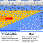
- FREEZING RAIN (DRIZZLE)
- Rain (drizzle) which freezes on contact to produce a coating of ice on the ground and other exposed surfaces.
- FRONT
- The transition zone between two distinct airmasses. The basic frontal types are cold fronts, warm fronts and occluded fronts.
- FROPA
- Frontal Passage.
- FROST
- The formation of thin ice crystals on the ground or other surfaces in the form of scales, needles, feathers, or fans. Frost develops under conditions similar to dew, except the temperatures are colder.
- FUJITA SCALE
- System developed by Dr. Theodore Fujita to classify tornadoes based on wind damage. Scale is from F0 for weakest to F5 for strongest tornadoes.
- FUNNEL CLOUD
- A rotating column of air forming a pendant from a cumulus/cumulonimbus cloud with circulation.
- FWC
- Forecasted Weather Conditions.
G
- GALE
- Wind speeds from 39 to 54 mph (34 to 47 knots).
- GEOSPHERE
- the non-living, solid portion of the Earth, including rocks.
- GEOSTATIONARY SATELLITE
- A satellite that rotates at the same rate as the earth, thus remaining over the same spot above the equator.
- GLAZE
- A layer or coating of ice that is generally smooth and clear, and forms on exposed objects by the freezing of liquid raindrops.
- GLOBAL DIMMING
- the reduction in the amount of solar radiation at the Earth’s surface, through the presence of aerosols.
- GOES
- Geostationary Operational Environmental Satellite.
- GRADIENT
- The time rate or spatial rate of change of an atmospheric property.
- GRAVITY
- The attraction of two masses to one another. Large masses have higher values of gravitational accelerations than lighter masses.
- GREENHOUSE EFFECT
- The warming of the atmosphere by the trapping of earth’s longwave radiation being radiated to space. The gases most responsible for this effect are water vapor and carbon dioxide.
- GROUND FOG
- Fog produced over the land by the cooling of the lower atmosphere as it comes in contact with the ground. Also known as radiation fog, and in parts of California as tule fog.
- GROWING SEASON
- The period of time between the last killing frost of spring and the first killing frost of autumn.
- GULF STREAM
- the Gulf Stream is a warm ocean current originating near the Caribbean and the Gulf of Mexico which follows the east coast of the USA before turning into the North Atlantic Drift towards north west Europe. This combined system transports heat from low to high latitudes, keeping north west European winter temperatures higher than they would otherwise be.
- GUST
- A brief sudden increase in wind speed. Generally the duration is less than 20 seconds and the fluctuation greater than 10 mph.
- GUST FRONT
- The leading edge of the downdraft from a thunderstorm.
H
- HAIL
- Precipitation of small balls or other pieces of ice (hailstones) falling separately or frozen together in irregular lumps. (Typically associated with thunderstorms and surface temperatures above freezing)
- HALO
- Ring or arc that seem to encircle the sun or moon. Caused by the refraction of light through the ice crystals in cirrus clouds.
- HARD FREEZE
- Freeze where vegetation is killed and the ground surface is frozen solid.
- HAZE
- Fine dry or wet dust or salt particles in the air that reduce visibility.
- HEAT INDEX
- The HI is the temperature the body feels when the heat and humidity are combined.
- HEAT LOW
- The thermal induced surface low pressure trough that develops during the warm season in the lee of the Cascades.</
- HEAVY SNOW
- In the Inland Northwest, mountains above 3000 feet – 8 to 12 inches in 12 hours or 12-18 inches or more in 24 hours. For the valleys and Basin below 3000 feet – 4 inches in 12 hours and 6 inches in 24 hours.
- HELICITY
- Streamwise vorticity available for ingestion into a thunderstorm. Higher values are favorable for a rotating updraft (greater than 400). A measure of low level wind shear, normally within the lowest 3 km of the atmosphere, relative to the movement of a thunderstorm (thus referred to as 0-3 km Storm Relative Helicity). This gives forecasters an indication of an environment that is favorable for supporting the development of thunderstorms with rotating updrafts, a precursor to supercell thunderstorms (the most violent of severe storms) and tornado development. Values of helicity greater than +150 are considered significant; however, like CAPE values, there is no magic value of (positive) helicity under which rotating thunderstorms will not develop. Helicity is only an index to determining thunderstorm rotation potential.
- HIC
- Hydrologist In Charge.
- HIGH
- The center of an area of high pressure, usually accompanied by anticyclonic and outward wind flow. Also known as an anticyclone.
- HIGH WINDS
- Winds of 40 mph or greater lasting for an hour or more , and/or gusts to 58 mph or greater.
- HORIZONTAL VORTICITY
- A rotation of air caused by vertical speed or directional wind shear.
- HORSE LATITUDES
- Subtropical regions where anticyclones produce settled weather.
- HUMIDITY
- The amount of water vapor in the atmosphere. (See relative humidity).
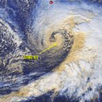
- HURRICANE
- A severe tropical cyclone with wind speeds in excess of 74 mph (64 knots).
- HYDROLOGIC CYCLE
- The composite picture of the interchange of water substance between the earth, the atmosphere and the seas which includes the change of state and vertical and horizontal transport.
- HYGROMETER
- An instrument used to measure humidity.
I
- ICE JAM
- An accumulation of broken river ice caught in a narrow channel that frequently produces local floods during a spring break-up.
- ICE STORM
- Liquid rain falling and freezing on contact with cold objects creating ice build-ups of 1/4th inch or more that can cause severe damage.
- INFLOW
- Wind speed, in knots, of the average PBL windspeed.
- INSTABILITY
- Instability caused by very dry air advecting in the mid-levels of the troposphere over a warm and moist lower troposphere. Dynamic lifting causes the mid-levels to cool at a greater rate than the lower troposphere.
- INTERPOLATION
- Drawing an isopleth between known numerical values
- INVERSION
- An increase in temperature with height. The reverse of the normal cooling with height in the atmosphere.
- INVERTED TROF
- This is a trough which bulges to the north. Mid-latitude troughs have a north to south amplitude but in the tropics the opposite is the case. Inverted trough look like ridges but there is lower pressure at their centers of curvature. Inverted troughs can occur across areas of the tropics and sub-tropics.
- INVOF
- In the Vicinity OF
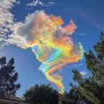
- IRIDESCENCE
- Brilliant patches of green or pink sometimes seen near the edges of high- or medium-level clouds.
- ISALLOBAR
- A line of equal surface pressure change.
- ISENTROPIC LIFT
- DECENT– Lifting or sinking of air along constant potential temperature (theta) surfaces. WAA (especially over shallow frontal boundaries) leads to lift while CAA leads to decent.
- ISOBAR
- A line of equal barometric pressure on a weather map.
- ISODROSOTHERM
- A line of constant dewpoint temperature.
- ISOHYET
- A line of equal rainfall.
- ISOLATED
- Showers covering less than 15 percent of an area.
- ISOPLETH
- A line of a constant meteorological value.
- ISOTACH
- A line of constant wind speed.
- ISOTHERM
- The line of equal temperature denoted on surface weather maps.
- ITCZ
- Inter-tropical Convergence Zone. The region where the northeasterly and southeasterly tradewinds converge, forming an often continuous band of clouds or thunderstorms near the equator.
J
- JET STREAK
- A relative maximum of windflow within the jet stream.
- JET STREAM
- Strong winds concentrated within a narrow band in the atmosphere. The jet stream often “steers” surface features such as fronts and low pressure systems.
K
- KATABATIC WIND
- Local winds a result of cold, dense air flowing downhill.
- KELVIN
- A ratio temperature scale using 0 as the theoretical coldest temperature.
- KNOT
- One nautical mile per hour (1.15 mph).
L
- LA NIÑA
- The opposite of El Niño, when a major cooling occurs in the equatorial waters in the Pacific Ocean which is characterized by shifts in “normal” weather patterns.
- LAND BREEZE
- A wind that blows from the land towards a body of water. Also known as an offshore breeze.
- LAPSE RATE
- The change in temperature with altitude in the atmosphere.
- LATENT HEAT
- The heat energy that must be absorbed when a substance changes from solid to liquid and liquid to gas, and which is released when a gas condenses and a liquid solidifies.
- LEE TROUGH
- Low pressure which develops just east of the Rocky Mountains or Cascades. Often lee troughs become organized into mature cyclones as they develop eastward.
- LIFTED INDEX
- The environmental temperature at 500 millibars minus the 500 millibar parcel temperature on a Skew-T diagram. Negative LI values are unstable.
- LIGHTNING
- An electrical discharge from a thunderstorm.
- LIKELY
- In probability of precipitation statements, the equivalent of a 60 or 70 percent chance.
- LLJ
- Low Level Jet. Strong Planetary Boundary Layer winds which advect warmer temperatures and moisture into the forecast area.
- LOW
- The center of an area of low pressure, accompanied by cyclonic and inward wind flow in the northern hemisphere. Also known as a cyclone.
M
- MACROBURST
- Large downbursts with 2.5 miles or larger outflow diameter and damaging winds lasting 5 to 20 minutes. Intense macrobursts could cause tornado-force damage.
- MARINE PUSH
- A regional phenomena where the heat low shifts east across the Pacific Northwest, along an onshore flow of cool, marine air to spill over the Cascades. It is characterized by a gusty winds and the potential of convection across the Inland Northwest.
- MARITIME AIR MASS
- Moist air mass originating over the ocean.
- MCS
- Mesoscale Convective System. A large cluster of thunderstorms and rain. Can be a squall line, multi-cells or a mesoscale convective complex.
- MEASURABLE
- Precipitation of 0.01″ or more.
- MESOCYCLONE
- The rotating updraft in a supercell thunderstorm
- METEOROLOGY
- The study of the atmosphere and atmospheric phenomena.
- MIC
- Meteorologist In Charge.
- MICROBURST
- Small downbursts, less than 2.5 miles in outflow diameter, with peak winds lasting 2 to 5 minutes. They may induce dangerous wind and downflow wind shears which can affect aircraft performance.
- MICROCLIMATE
- A local set of atmospheric conditions that differ from those in the surrounding areas, often slightly but sometimes substantially.
- MICROWAVE RADIATION
- Electromagnetic radiation which comprises the highest frequency radio energy.
- MID
- UPPER LEVEL SUPPORT– This is in reference to either positive differential vorticity advection or a jet streak creating upper level divergence. These processes result in a dynamic lifting of air.
- MILLIBAR
- A unit of atmospheric pressure. 1 mb = 100 Pa (pascal). Normal surface pressure is approximately 1013 millibars.
- MIST
- Very fine water droplets at ground level.
- MIXING DEPTH
- The vertical distance the process of convection mixes the air from the surface to aloft. The mixing depth is often the same depth as the PBL. The mixing depth will increase with solar warming of the surface and increased low level wind speed. Could also be in reference to the depth of the “transition zone” between two air masses that are horizontally deferentially advecting one over the other.
- MM5
- the Mesoscale Model Version 5. One of these models is run at the Department of Atmospheric Sciences at the University of Washington which covers the weather over Washington, Oregon and most of Idaho.
- MOISTURE AXIS RIDGE
- An area of higher moisture values, usually in the form of a ridge of higher dewpoints at the surface or 850 mb. Low level moisture axes enhance atmospheric instability, which in turn promotes thunderstorm development. Existing storms can intensify by moving into moisture axes. The concept is similar to dewpoint pooling.
- MONSOON
- A persistent seasonal wind, often responsible for seasonal precipitation regime.
- MOS
- Model Output Statistics (usually in reference to NGM model). These are numerical representations of expected weather such as forecasted temperatures and precipitation chances.
- MOSTLY CLEAR
- Between 1/10 and 3/10 cloud cover
- MOSTLY CLEAR
- Between 1/10 and 3/10 cloud cover.
- MOSTLY CLOUDY
- Between 7/10 and 9/10 cloud cover.
- MOSTLY SUNNY
- Between 1/10 and 3/10 cloud cover
- MRF
- Medium Range Forecast model generated every 12 hours by NCEP.
- MSLP
- Mean sea level pressure.
N
- NATIONAL BLEND OF MODELS (NBM)
- A nationally consistent and skillful suite of calibrated forecast guidance based on a blend of both NWS and non-NWS numerical weather prediction model data and post-processed model guidance.
- NCEP
- National Centers for Environmental Prediction. Central computer and communications facility of the National Weather Service; located in Washington, DC.
- NEGATIVE TILTED TROUGH
- A trough which tilts from the northwest toward the southeast. This situation creates instability since cold temperatures in the mid and upper levels advect over warmer air at the surface. A negative tilt is a sign a trough is mature.
- NEXRAD
- NEXt Generation RADar. A NWS network of about 140 Doppler radars operating nationwide.
- NGM
- Nested Grid Model generated every 12 hours by NCEP
- NHC
- National Hurricane Center. The office of the National Weather Service in Miami that is responsible for tracking and forecasting tropical cyclones.
- NOAA
- National Oceanic and Atmospheric Administration. A branch of the US Department of Commerce, NOAA is the parent organization of the National Weather Service.
- NOAA WEATHER RADIO (NWR)
- Continuous, 24 hour-a-day VHF broadcasts of weather observations and forecasts directly from National Weather Service offices. A special tone allows certain receivers to alarm when watches or warnings are issued.
- NOAA WEATHER WIRE (NWWS)
- Mass dissemination via satellite of National Weather Service products to the media and public.
- NOMAD BOUY’s
- Anchored Automated Weather Stations.
- NORTH ATLANTIC DRIFT
- the Gulf Stream is a warm ocean current originating near the Caribbean and the Gulf of Mexico which follows the east coast of the USA before turning into the North Atlantic Drift towards north west Europe. This combined system transports heat from low to high latitudes, keeping north west European winter temperatures higher than they would otherwise be.
- NUBILOGRAPH
- Art of Drawing clouds.
- NUMERICAL WEATHER PREDICTION (NWP)
- Forecasting weather by the use of numerical models, run on high speed computers. Most of the NWP for the National Weather Service is done at the National Centers for Environmental Prediction (NCEP).
- NUMEROUS
- Showers covering more than 54 percent of an area.
- NWS
- National Weather Service.
O
- OCCLUDED FRONT
- A complex frontal system that occurs when a cold front overtakes a warm front. Also known as an occlusion.
- OFFSHORE WATERS
- Ocean waters from 60 nm to 250 nm.
- OMEGA
- A term used to describe vertical motion in the atmosphere. The “omega equation” used in numerical weather models is composed of two terms, the “differential vorticity advection” term and the “thickness advection” term. Put more simply, omega is determined by the amount of spin (or large scale rotation) and warm (or cold) advection present in the atmosphere. On a weather forecast chart, high values of omega (or a strong omega field) relate to upward vertical motion in the atmosphere. If this upward vertical motion is strong enough and in a sufficiently moist airmass, precipitation results.
- OPEN WAVE
- A wave of low pressure that does not have a complete circulation around it; also called a short wave trough.
- OROGRAPHIC UPLIFT
- The vertical forcing of air by terrain features such as hills or mountains. This can create orographic clouds and/or precipitation.
- OVERCAST
- Sky condition when greater than 9/10 of the sky is covered
- OVERSHOOTING TOP
- A ‘bubble’ of cloud sticking up above the anvil of a thunderstorm, due to a vigorous updraft within the storm.
- OZONE
- A form of oxygen containing 3 molecules, usually found in the stratosphere, and responsible for filtering out much of the sun’s ultraviolet radiation.
- OZONE
- a molecule, which in the upper atmosphere (stratosphere) filters potentially damaging ultraviolet light from reaching the Earth’s surface.
P
- PACIFIC HIGH
- A semipermanent anticyclone located in the Eastern North Pacific.
- PACKAGE
- A compilation of analysis and forecast charts and their interpretation.
- PALEAOCLIMATE
- climate prior to the development of climate measuring instruments, details of which are acquired from so-called proxy data, e.g. from ice sheets, tree rings, sediment, and rocks.
- PARTLY CLOUDY
- Sky condition when between 3/10 and 7/10 of the sky is covered.
- PARTLY SUNNY
- Sky condition when between 3/10 and 7/10 of the sky is covered.
- PBL
- Planetary Boundary Layer. The lowest level of the atmosphere where friction is an important force and vertical mixing is common.
- PD
- Period.
- PERMAFROST
- A soil layer below the surface of tundra regions that remains frozen permanently.
- PG
- Pressure gradient. Tightening pressure gradient indicates stronger winds.
- PHASING
- When two separate short waves come together to form one wave. Also, when upper and lower level features are positioned so that each provides energy to the other, it is said that the features are in phase with one another.
- PINEAPPLE EXPRESS
- A warm and moist flow of air with origins from the tropics which precedes major winter storms. It can bring significant rain and snow to the Pacific Northwest.
- POP
- Probability of Precipitation. This is the chance the NWS gives to precipitation across there forecast region. It may also refer to the POP a forecast model is predicting.
- POSITIVE ISOTHERMAL VORTICITY ADVECTION
- Advection of higher values of vorticity by the thermal wind on a map of vorticity and thickness contours. Implies an area of rising motion.
- POSITIVE TILTED TROUGH
- A trough which tilts from the northeast toward the southwest. Often a trough is positive tilted in it’s development stage.
- POTENTIAL
- INSTABILITY- Also known as convective instability. Instability caused by dry air advecting over warm and humid PBL air. Lapse rate of temperature increases if lifting occurs.
- PRECIPITABLE WATER
- (PW, PCPTBL WTR or H2O)– Total amount of water vapor in a layer of air, expressed in inches. Normally taken between 1000 and 500 mb. Higher values of precipitable water indicate a deep moisture layer, increasing the potential for heavy precipitation amounts.
- PRECIPITATION
- Liquid or solid water molecules that fall from the atmosphere and reach the ground.
- PRESSURE
- The force exerted by the interaction of the atmosphere and gravity. Also known as atmospheric pressure.
- PROFILER
- A remote ground-based sensing instrument that measures wind speed and direction at different levels of the atmosphere. The new National Weather Service WSR-88D radar has this capability, and its vertical wind profile is called a VAD Wind Profile (or VWP). VAD stands for Velocity Azimuth Display.
- PROG
- Model forecasted output
- PROGRESSIVE FLOW
- An upper level flow pattern in which storm systems move along at a fairly regular pace.
- PROGRESSIVE PATTERN
- An upper level flow pattern in which storm systems move along at a fairly regular pace.
- PTWC
- Pacific Tsunami Warning Center, located in Honolulu, HI.
- PUNCH
- A fast moving mass of air (e.g. dry punch, cold punch)
- PUSH
- A fast moving mass of air (e.g. dry punch, cold punch)
- PWAT
- Precipitable Water value(s)
Q
- QG Forcing
- Upward vertical velocity generated by low level convergence or upper level divergence. Example of phenomena that produce upward QG forcing include low level warm air and moisture advection, positive differential vorticity advection, and the right rear and left front quadrant of a jet streak. If QG forcing is in reference to sinking air, example that cause this are low level cold air and dry air advection, negative differential vorticity advection, and the left rear and right front quadrants of a jet streak.
- QPF
- Quantitative Precipitation Forecast
- Q–VECTORS
- (QVEC, DIVQ)– A mathematical entity (Q-vectors do not exist in the atmosphere) that allows forecasters to better identify areas of vertical motion. Q-vectors essentially show vertical motions arising from the combination of differential vorticity advection (changes of advection with height) and temperature (thickness) advection. Areas where Q-vectors converge implies upward motion and Q–vectordivergence (DIVQ) implies an area of sinking motion. Note: Negative Q-vector divergence is the same mathematically as Q-vector convergence, so the statement “…negative divq…” means Q-vector convergence.
R
- RA
- Rain.
- RADAR
- An instrument used to detect precipitation by measuring the strength of the electromagnetic signal reflected back. (RADAR= Radio Detection and Ranging)
- RADIATION FOG
- See ground fog.
- RADIOSONDE
- An instrument attached to a weather balloon that measures and transmits pressure, humidity, temperature, and winds as it ascends.
- RAIN
- Precipitation of liquid water particles which, in contrast to drizzle, are widely separated and larger in size.
- RAINBOW
- Optical phenomenon when light is refracted and reflected by moisture in the air into concentric arcs of color.
- RELATIVE HUMIDITY
- The amount of water vapor in the air, compared to the amount the air could hold if it was totally saturated. (Expressed as a percentage).
- RETROGRADE
- To move backwards. It relates to a ridge or trough moving from east to west. Typically in the mid-latitude, troughs and ridges move west to east. Retrograde motion is the opposite movement of normal.
- RFC
- River Forecast Center. The California/Nevada River Forecast Center is located in Sacramento.
- RIDGE
- An elongated area of high pressure in the atmosphere.
- RING OF FIRE
- This refers to thunderstorms and rain across the edges of a high pressure ridge. If a ridge occurs across the central US in summer, the ring of fire will extend across the west coast, up into Canada and across the east coast. Underneath the main core of the ridge weather will be stable.
- ROSSBY WAVES
- long waves that form in air or water that flows almost parallel to the equator, which results form the effect of the earth’s rotation.
- RUC
- Rapid Update Cycle model generated every 3 hours. The model is run each hour, with its initial conditions updated by the inclusion of the latest surface observations available. Its primary usage is for aviation and severe weather forecasting.
S
- SCATTERED CLOUDS
- Sky condition when between 1/10 and 5/10 are covered.
- SCATTERED SHOWERS
- Showers covering 25 to 54 percent of an area.
- SEA BREEZE
- A wind that blows from a sea or ocean towards a land mass. Also known as an onshore breeze.
- SEA SURFACE TEMPERATURE
- Surface temperature data collected using IR satellite imagery, buoy and ship data.
- SEVERE THUNDERSTORM
- A thunderstorm with winds of 58 mph or more or hail 3/4-inch diameter or larger. Structural wind damage may imply the occurrence of a severe thunderstorm.
- SHELF CLOUD
- Long, wedge-shaped clouds associated with the gust front. Shelf clouds indicate the downdraft or outflow of a thunderstorm.
- SHORTWAVE
- a progressive wave in a horizontal air flow that leads to lower air pressure and possibly unsettled weather.
- SHOWER
- Precipitation that is intermittent, in space, time, or intensity and is falling from a cumuliform cloud.
- SLEET
- Solid grains of ice which form from the freezing of raindrops or the refreezing of melted snowflakes. These small, transparent ice pellets usually bounce when they hit a hard surface.
- SLIGHT CHANCE
- In probability of precipitation statements, usually equivalent to a 20 percent chance.
- SMOG
- Pollution formed by the interaction of pollutants and sunlight (photochemical smog), usually restricting visibility, and occasionally hazardous to health.
- SNOW
- Unless qualified by such words as ” occasional” or ” intermittent” , a prediction of snow indicates a steady fall of a few hours or more.
- SNOW FLURRIES
- Short duration of intermittent light snowfall with little if any accumulations.
- SNOW SQUALL
- A sudden onset of heavy snowfall with blowing snow and strong, gusty surface winds. Often referred to as a whiteout.
- SOO
- Science and Operations Officer.
- SOUTHERN OSCILLATION
- A periodic reversal of the pressure pattern across the tropical Pacific Ocean during El Nino events.
- SPRING TIDE
- Semi-monthly tide of increased height due to the new or full moon.
- SPS
- Special Statement.
- SQUALL LINE
- A line of thunderstorms or squalls extending over several hundred miles.
- STABLE AIR
- air with little or no tendency to rise, that is usually accompanied by clear dry weather.
- STACKED
- A pressure system which shows up in the same general location on every height analysis or forecast chart. This is an indication low pressure is weakening (filling) or a pressure system is stalling.
- STATIONARY FRONT
- A transition zone between air masses, with neither advancing upon the other.
- STING JET
- A localized, narrow band of intense winds that forms in the later stages of an extratropical cyclone. Sting jets can produce wind speeds exceeding 160 kilometers per hour (100 mph), causing significant damage over a small area.
- STRAIGHT LINE WINDS
- Damaging thunderstorm winds produced as air rushes downward from a thunderstorm. Often called gust fronts, down burst, or micro burst winds these winds originate from thunderstorm downdrafts and may produce damage similar to that of a tornado.
- STRATOSPHERE
- The layer of the atmosphere above the troposphere, where temperature increases with height.
- STRATUS
- Flat low level clouds.
- SUBSIDENCE
- Sinking air that is associated with warming air and little cloud formation.
- SUBTROPICAL JET
- The branch of the jet stream that is found in the lower latitudes.
- SUPERCELL
- A highly organized thunderstorm with a rotating updraft, known as a mesocyclone. It poses an inordinately high threat to life and property. Often produces large hail, strong winds, and tornadoes.
- SUPERCOOLED WATER
- water that stays in liquid form if undisturbed even though it has been cooled to a temperature below its normal freezing point.
- SUSTAINED WINDS
- The wind speed obtained by averaging the observed values over a one minute period.
- SWELLS
- Ocean waves of regular and longer duration than wind waves.
T
- TCU
- Towering Cumulus Clouds.
- TEMPERATURE
- a measure of the warmth or coldness of an object or substance with reference to a standard value.
- THERMAL
- Small rising column of air due to surface heating
- THERMODYNAMICS
- In reference to the (in)stability of the atmosphere. Important thermodynamic information includes lapse rates, CAPE, changes in temperature / moisture with height, and cap strength.
- THERMOHALINECIRCULATION (THC)
- the world’s large-scale ocean circulation driven by differences in temperature and salinity of the water masses.
- THUNDER
- The sound wave produced as a lightning stroke heats the air causing it to rapidly expand.
- THUNDERSTORM
- (TS, TSRA, TSTM) – A shower accompanied by thunder. It is always accompanied by lightning and thunder, and occasionally by strong gusty winds, hail, and or heavy rain.
- TORNADO
- A violent rotating column of air, usually forming a pendant from a cumulonimbus cloud with the circulation reaching the ground. It nearly always starts as a funnel cloud and may be accompanied by a loud roaring noise. On a local scale, it is the most destructive of all atmospheric phenomena.
- TRACE
- Precipitation amounts less than 0.01″.
- TRADE WINDS
- Persistent tropical winds that blow from the subtropical high pressure centers towards the equatorial low.
- TROPICAL DEPRESSION
- Tropical mass of thunderstorms with a cyclonic wind circulation and winds between 20 and 34 knots.
- TROPICAL DISTURBANCE
- An organized mass of tropical thunderstorms, with a slight cyclonic circulation, and winds less than 20 knots.
- TROPICAL STORM
- An organized cyclone in the tropics with wind speed between 35 and 64 knots.
- TROPOSPHERE
- The lowest layer of the atmosphere where the temperature decreases with height. Most of earth’s weather occurs in this layer.
- TROUGH
- An elongated area of low pressure at the surface or aloft.
- TSUNAMI
- An ocean wave generated by a submarine earthquake, volcano or landslide. (Also known as a seismic seawave, and incorrectly as a tidal wave).
- TURBULENCE
- Disrupted flow in the atmosphere that produces gusts and eddies.
- TWEAK
- To change slightly. Often in reference to slightly changing MOS output or any other form of model guidance.
- TYPHOON
A hurricane that forms in the Western Pacific Ocean.
U
- UKMET
- United Kingdom forecast model.
- UNSTABLE AIR
- air that rises easily and can form clouds and rain.
- UPWELLING
- The rising of cold water from the deeper areas of the ocean to the surface. This phenomena often occurs along the California coast during the summer.
V
- VEERING WINDS
- A clockwise change in wind direction. Veering winds with height are indicative of warm air advection (WAA).
- VERY WINDY
- Sustained winds of 30 to 40 mph.
- VIRGA
- Precipitation falling from the base of a cloud and evaporating before it reaches the ground.
- VISIBILITY
- The horizontal distance an observer can see and identify a prominent object.
- VORTICITY
- A measure of the amount of “spin” (rotation) and “shear” in the atmosphere.
W
- WAA
- Warm Air Advection.
- WALL CLOUD
- An isolated lowering of a cloud that is attached to the rain-free base of a thunderstorm, generally to the rear of the visible precipitation area. Wall clouds indicate the updraft of or the inflow to a thunderstorm.
- WARM FRONT
- A boundary between a warm airmass that is replacing a cooler airmass.
- WARNING
- is issued when severe or hazardous weather has already developed and has been reported by spotters or indicated by radar. Warnings are statements of imminent danger and are issued for relatively small areas near and downstream from the severe storm or flood. For example, Tornado Warning, Severe Thunderstorm Warning, Flash Flood Warning, Winter Storm Warning.
- WATCH
- identifies a relatively large area in which hazardous or severe weather might occur. The watch is only an indication of where and when the severe weather probabilities are the highest, and should not be confused with a warning. Examples include Tornado Watch, Severe Thunderstorm Watch, Flash Flood Watch, Winter Storm Watch.
- WATER VAPOR
- water substance in a gaseous state that comprises one of the most important of all the constituents of the atmosphere.
- WATERSPOUT
- A violently rotating column of air usually forming a pendant from a cumulus/cumulonimbus cloud, occurring over a body of water, and having circulation reaching the water.
- WCM
- Warning Coordination Meteorologist.
- WFO
- Weather Forecast Office. Designation of NWS operational offices after modernization.
- WIND
- air in motion relative to the surface of the earth.
- WIND ADVISORY
- Sustained winds 25 to 39 mph and/or gusts to 57 mph. Issuance is normally site specific. However, winds of this magnitude occurring over an area that frequently experiences such winds (e.g., the normal strong summertime winds near the San Francisco Bay, would not require the issuance of this product).
- WIND CHILL
- The apparent temperature that describes the cooling effect on exposed skin by the combination of temperature and wind, expressed as a loss of body heat. An increase in wind speed or decrease in temperature will accelerate the effect. A wind chill factor of 30 degrees or lower on exposed skin will result in frostbite in a short period of time.
- WIND SHEAR
- The change of wind speed or direction with distance or height.
- WIND VANE
- An instrument that determines the direction from which a wind is blowing.
- WINDY
- Sustained winds of 20 to 30 mph.
- WINTER WEATHER ADVISORY
- An advisory issued when snow is expected to create hazardous or restricted travel conditions, but not as severe as expected with a winter storm.
- WRCC
- Western Regional Climate Center, Reno, NV.
- Weather Bomb
- A storm where the central pressure drops by at least 24 millibars in 24 hours.
X
- X-BAND
- A frequency band of microwave radiation in which radars operate.
Y
Z
- ZFP
- Zone Forecast Product. The collective of public forecasts for a NWS office area of responsibility.
- ZONAL WIND
- the wind or wind component along the local parallel of latitude.
This is a compiled glossary using multiple sources
Total 0 Votes
0
0
Tell us how can we improve this post?

Hi I am Marcus, MM0ZIF, a licenced Radio Amateur, Doctor of Musicology, amateur weather enthusiast. I over the years have been a Amateur Radio Tutor, Examiner, and a Regional Manager for the Radio Society of Great Britain.
This site is dedicated more towards Amateur Radio and Weather, with an angle on Technology too. I also maintain https://havenswell.com/ which is my other blog which is more aimed at cooking, hobbies and life in general as well as businness and networking.
- MM0ZIF

- MM0ZIF
- MM0ZIF
- MM0ZIF

- MM0ZIF

- MM0ZIF

- MM0ZIF
- MM0ZIF
- MM0ZIF
- MM0ZIF
- MM0ZIF

- MM0ZIF

- MM0ZIF

- MM0ZIF
- MM0ZIF

- MM0ZIF
- MM0ZIF

- MM0ZIF
- MM0ZIF

- MM0ZIF

- MM0ZIF

- MM0ZIF

- MM0ZIF
- MM0ZIF

- MM0ZIF

- MM0ZIF

- MM0ZIF

- MM0ZIF

- MM0ZIF

- MM0ZIF
- MM0ZIF
- MM0ZIF

- MM0ZIF

- MM0ZIF

- MM0ZIF

- MM0ZIF

- MM0ZIF
- MM0ZIF

- MM0ZIF
- MM0ZIF
- MM0ZIF
- MM0ZIF
- MM0ZIF

- MM0ZIF

- MM0ZIF
- MM0ZIF
- MM0ZIF

- MM0ZIF

- MM0ZIF
- MM0ZIF

- MM0ZIF

- MM0ZIF

- MM0ZIF

- MM0ZIF

- MM0ZIF

- MM0ZIF
- MM0ZIF
- MM0ZIF

- MM0ZIF

- MM0ZIF

- MM0ZIF

- MM0ZIF
- MM0ZIF

- MM0ZIF
- MM0ZIF
- MM0ZIF

- MM0ZIF

- MM0ZIF

- MM0ZIF

- MM0ZIF

- MM0ZIF

- MM0ZIF

- MM0ZIF

- MM0ZIF

- MM0ZIF

- MM0ZIF

- MM0ZIF

- MM0ZIF

- MM0ZIF

- MM0ZIF
- MM0ZIF
- MM0ZIF

- MM0ZIF

- MM0ZIF

- MM0ZIF

- MM0ZIF

- MM0ZIF
- MM0ZIF
- MM0ZIF
- MM0ZIF
- MM0ZIF
- MM0ZIF
- MM0ZIF
- MM0ZIF
- MM0ZIF
- MM0ZIF
- MM0ZIF
- MM0ZIF

- MM0ZIF

- MM0ZIF

- MM0ZIF

- MM0ZIF

- MM0ZIF

- MM0ZIF

- MM0ZIF

- MM0ZIF
- MM0ZIF

- MM0ZIF

- MM0ZIF

- MM0ZIF

- MM0ZIF

- MM0ZIF

- MM0ZIF

- MM0ZIF

- MM0ZIF

- MM0ZIF

- MM0ZIF

- MM0ZIF

- MM0ZIF

- MM0ZIF

- MM0ZIF
- MM0ZIF

- MM0ZIF

- MM0ZIF

- MM0ZIF
- MM0ZIF
- MM0ZIF
- MM0ZIF
- MM0ZIF

- MM0ZIF
- MM0ZIF
- MM0ZIF

- MM0ZIF

- MM0ZIF
- MM0ZIF
- MM0ZIF

- MM0ZIF

- MM0ZIF
- MM0ZIF
- MM0ZIF

- MM0ZIF

- MM0ZIF

- MM0ZIF

- MM0ZIF

- MM0ZIF
- MM0ZIF
- MM0ZIF

- MM0ZIF

- MM0ZIF
- MM0ZIF

- MM0ZIF
- MM0ZIF
- MM0ZIF
- MM0ZIF

- MM0ZIF
- MM0ZIF
- MM0ZIF

- MM0ZIF
- MM0ZIF

- MM0ZIF

- MM0ZIF
- MM0ZIF
- MM0ZIF
- MM0ZIF

- MM0ZIF
- MM0ZIF
- MM0ZIF

- MM0ZIF

- MM0ZIF
- MM0ZIF

- MM0ZIF
- MM0ZIF

- MM0ZIF
- MM0ZIF
- MM0ZIF
- MM0ZIF

- MM0ZIF
- MM0ZIF

- MM0ZIF
- MM0ZIF
